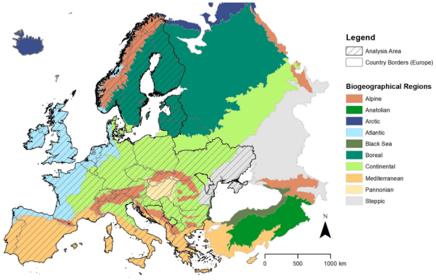
This study aims at identifying underutilized land potentially suitable for bioenergy production in Europe by means of remote sensing time series analysis.
The background is the Revised Renewable Energy Directive (REDII) requesting that 32% of Europe’s energy production shall come from renewable energy sources until 2030. In order to avoid the food versus fuel debate, we only considered land that has not been used in the previous five years. Satellite remote sensing is the only technique that allows for the assessment of the usage of land for such a long time span at the pan-European scale with reasonable efforts. We used Landsat 8 (L8) data for the full five year time period 2015–2019 and included additional Sentinel-2 (S2) data for 2018 and 2019.
The analysis was based on a stratified approach for biogeographical regions and countries using Google Earth Engine. To our knowledge, this is the first work that employs high resolution time series data for pan-European mapping of underutilized land.
If you want to read the full study, you can find it here